Präsentation herunterladen
Die Präsentation wird geladen. Bitte warten

1
GEOGRAFÍA CON GEOLOGÍA Y BIOLOGÍA „CAMI DE-RONDA“ DE PUNTA PRIMA A S`AGARÓ Agrita Vaivode Kristine Vaivode Projektleiter Carlos Torrent Proceso de trabajo con Fotografias del Proyecto Europe 4 U

2
„CAMI DE RONDA“ DE PUNTA PRIMA A S`AGARÓ PLATJA D´ARO October – December 2015 19.10.15- 18.12.15 Fotografien entlang von ca. 2,8 km Meeresküste Die Strecke ist in 6 Sektoren geteilt Alle Fotos sind in 3 Kategorien eingeteilt– Geografie, Biologie und Geologie Mehr als 2000 Fotos wurden aufgenommen und 342 für das Projekt ausgewählt 10 Tage Exkursion Insgesamt 20 km gelaufen 40 Arbeitsstunden mit dem PC (Photoshop, Picasa, Lightroom, Google Earth, Panoramio)
.")
3
Geographische Lage

4
Geographisches Territorium des Projektes

5
6 Sektoren des Projektes

6
Arbeitstabellen - und Materialien des Projektes Erhalten der GPS Daten Arbeitstabelle

7
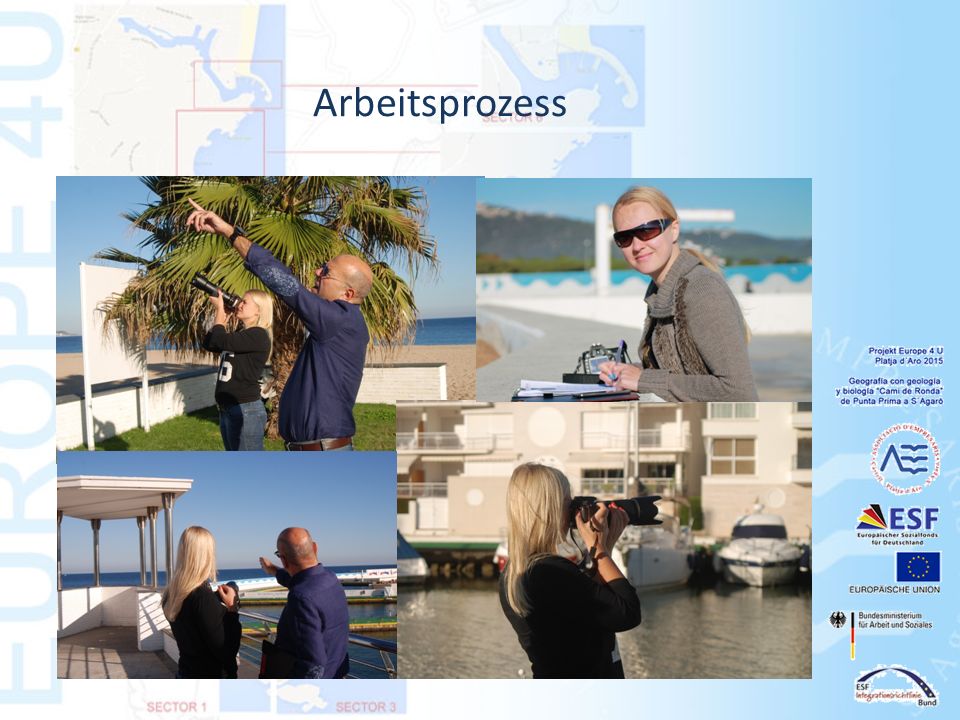
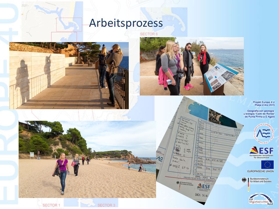
Arbeitsprozess

10
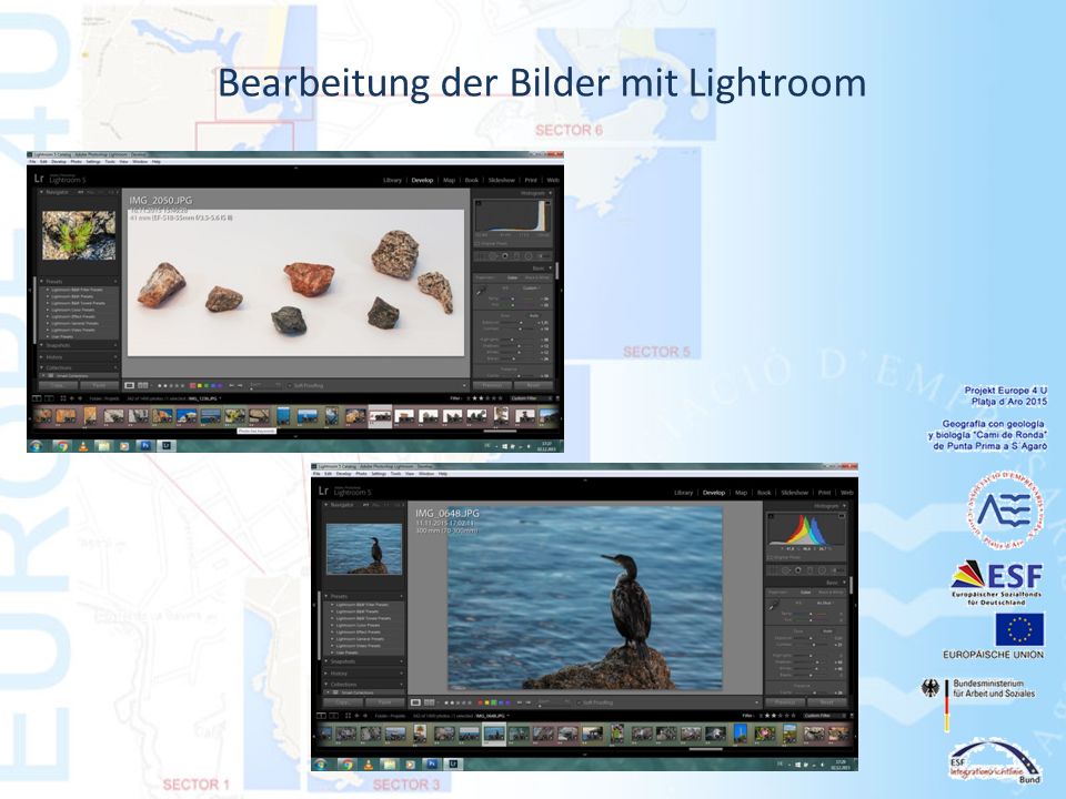
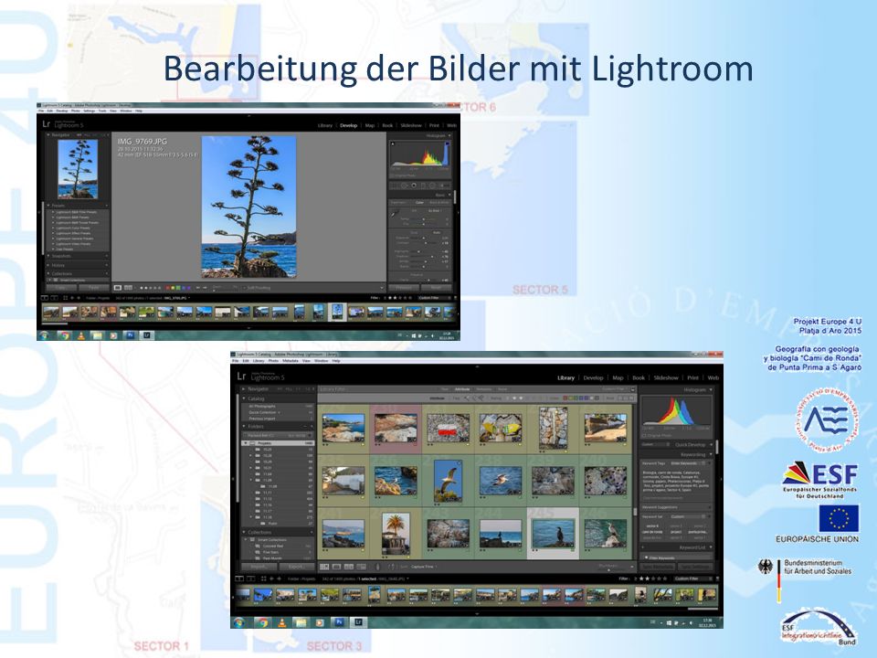
Bearbeitung der Bilder mit Lightroom

13
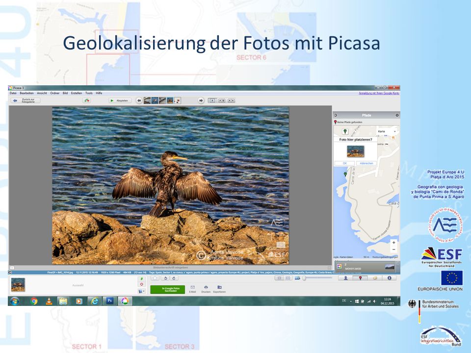
Arbeit mit Picasa (Zusammenführung von Foto und Ortsdaten)
")
14
Geolokalisierung der Fotos mit Picasa

16
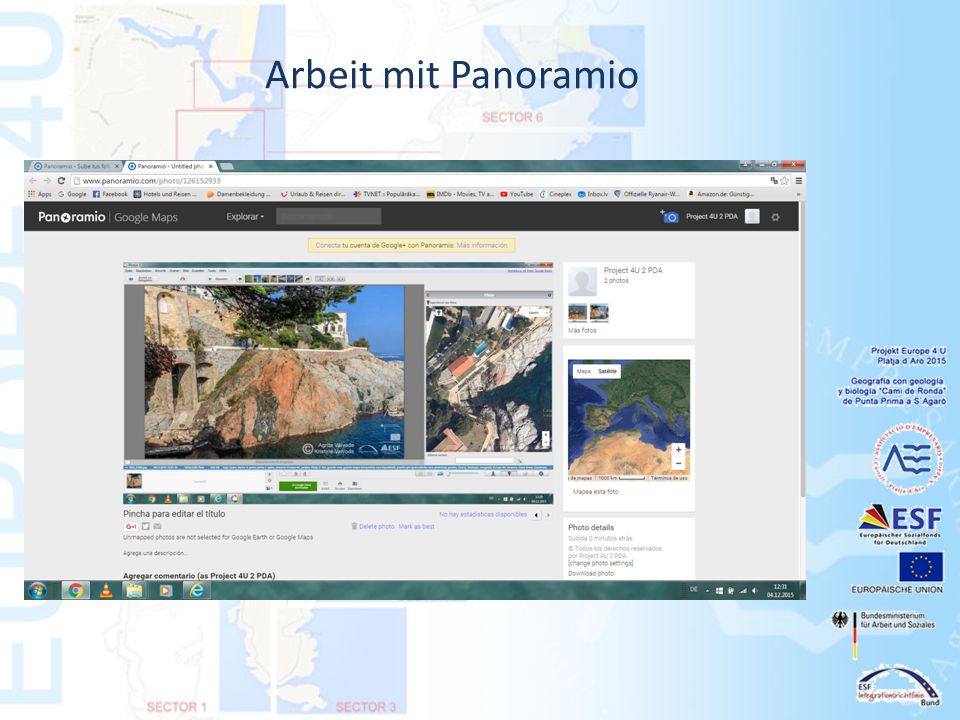
Arbeit mit Panoramio

19
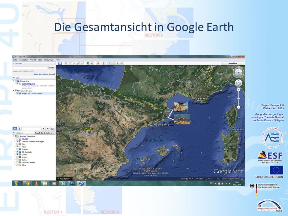
Die Gesamtansicht in Google Earth

21
Teilnehmer des Projektes Hauptleiterin des Projektes: Sol Calderon Projektleiter: Carlos Torrent Photographie, Realisation des Projektes: Agrita Vaivode, Kristine Vaivode www.empresarisplatjadaro.com/europe4U Offizielle Organisationen: Bundesministerium für Arbeit und Soziales Europäische Union ESF Integrationsrichtlinie Bund ESF Europäischer Sozialfonds für Deutschland Associació Empresaris, Castell Platja d´Aro s´Agaró

Ähnliche Präsentationen


>")


