Präsentation herunterladen
Die Präsentation wird geladen. Bitte warten

1
Klimawandel und die Aufgaben des Intergovernmental Panel on Climate Change (IPCC)
Dr. Nicole Estrella Fachgebiet für Ökoklimatologie Wissenschaftszentrum Weihenstephan für Ernährung, Landnutzung und Umwelt 08161 /

2
Geschichte des Klimawandels
1896 S. Arrhenius 1820 Fourier 1859 Tyndall 1959 Keeling 1941 Milankovitsch Der Treibhauseffekt wurde durch Jean Baptiste Joseph Fourier im Jahr 1824 entdeckt.[4] Ihm fiel auf, dass die Erde viel wärmer war, als sie bei grober Abschätzung gemäß der damals bekannten Strahlungsgesetze sein müsse. Er erkannte, dass die Atmosphäre sehr gut transparent für sichtbares Licht war, was den Boden und damit die unteren Atmosphärenschichten wärmte. Tyndal =Absorption der Gase: er identifizierte die für den Treibhauseffekt verantwortlichen Gase. der größte Teil des Treibhauseffekts von Wasserdampf herrührt, stelle fest, dass der Beitrag der übrigen Gase wie Kohlendioxid (CO2) oder Ozon zwar deutlich schwächer, aber nicht vernachlässigbar ist. Svante Arrhenius war von Tyndalls Idee fasziniert, dass wechselnde Konzentrationen von Kohlendioxid ein wesentliches Glied in der Erklärung der großen Temperatursprünge zwischen Warm- und Eiszeiten sein könne. Er berechnete letztlich ein stark vereinfachtes Klimamodell, was er während mehrerer Monate in Handarbeit ausführte (2xCO2=+4°C heute mit Rückopplungen 3°C). Im Jahr 1896 veröffentlichte er seine Ergebnisse zusammen mit der Hypothese, dass eine Halbierung der Kohlendioxidkonzentration ausreiche, eine Eiszeit einzuleiten. Herausragend war, dass er die von James Croll beschriebenen Eis-Albedo-Rückkopplung in seinen Berechnungen berücksichtigte.
 oder Ozon zwar deutlich schwächer, aber nicht vernachlässigbar ist. Svante Arrhenius war von Tyndalls Idee fasziniert, dass wechselnde Konzentrationen von Kohlendioxid ein wesentliches Glied in der Erklärung der großen Temperatursprünge zwischen Warm- und Eiszeiten sein könne. Er berechnete letztlich ein stark vereinfachtes Klimamodell, was er während mehrerer Monate in Handarbeit ausführte (2xCO2=+4°C heute mit Rückopplungen 3°C). Im Jahr 1896 veröffentlichte er seine Ergebnisse zusammen mit der Hypothese, dass eine Halbierung der Kohlendioxidkonzentration ausreiche, eine Eiszeit einzuleiten. Herausragend war, dass er die von James Croll beschriebenen Eis-Albedo-Rückkopplung in seinen Berechnungen berücksichtigte.")
3
Wer oder was ist das "Intergovernmental Panel on Climate Change„?
1988 von den Vereinten Nationen gegründet, er soll Politikberatung betreiben: Wie steht es um den Klimawandel? Was ist Ursache der Erderwärmung? Und was sollten die politisch Handelnden dagegen tun? 1990 erschien zum ersten Mal ein "Sachstandsbericht": Dieser attestierte ein menschengemachtes Problem und empfahl, globale Konferenzen zur Lösung einzuberufen. erste Sachstandsbericht des IPCC war geradezu revolutionär: Klimawandel ein von Menschen beeinflusstes Phänomen. Seitdem werden jährlich Klimakonferenzen abgehalten, die mit einer Frühjahrstagung am Sitz des UN-Klimasekretariats in Bonn beginnen und im Dezember mit einer Regierungskonferenz enden. In diesem Jahr findet bereits zum 19. Mal eine solche Konferenz statt: als COP 19 in Warschau. United Nations Climate Change Conference der Conference of the Parties- Weltklimakonferenz: Die UN-Generalversammlung nahm diesen Rat an und begann Verhandlungen über die Klimarahmenkonvention, die 1992 von den UN-Staaten angenommen wurde. 1995 trat dann in Berlin die erste "Conference of the Parties" (COP 1) der Klimarahmenkonvention zusammen. Das war die erste Weltklimakonferenz. Seitdem werden jährlich Klimakonferenzen abgehalten
 der Klimarahmenkonvention zusammen. Das war die erste Weltklimakonferenz. Seitdem werden jährlich Klimakonferenzen abgehalten.")
4
Wie arbeitet der IPCC? Der IPCC arbeitet "begutachtend" – englisch "peer review" Der IPCC betreibt selbst keine Wissenschaft, sondern prüft lediglich, ob die veröffentlichten Forschungsarbeiten zum Klimawandel plausibel sind und welches Gesamtbild sich daraus ergibt. Dies ist das übliche Verfahren für Fachpublikation Begutachtet wird vom IPCC aber auch sogenannte "Graue Literatur„. Die Leitautoren des Sachstandsberichts fügen die Ergebnisse zu einem Gesamtbild zusammen. "Graue Literatur", beispielsweise Statistiken der Bundesregierung, Konferenzberichte, Berichte von internationalen Organisationen wie der Umweltorganisation WWF oder der Internationalen Energieagentur IEA. Dies ist das übliche Verfahren für Fachpublikation Begutachtet wird vom IPCC aber auch sogenannte "Graue Literatur„. Die Leitautoren des Sachstandsberichts fügen die Ergebnisse zu einem Gesamtbild zusammen

6
Zeitlicher Ablauf WG 1 https://www.ipcc-wg1.unibe.ch/AR5/AR5.html

7
Prozess der Fachbegutachtung
Das Begutachtungsverfahren des IPCC-Prozesses und soll sicherstellen, dass der Bericht die aktuellen wissenschaftlichen Erkenntnisse ausgewogen und umfassend darstellt und bewertet. Die Begutachtung soll objektiv, offen und transparent sein, und so viele unabhängige Experten wie möglich involvieren, um eine große Bandbreite an Sichtweisen und Expertise zu repräsentieren „Falls Sie sich zum Kreis der geeigneten Expertinnen und Experten zählen, registrieren Sie sich bitte online auf der Webseite der AG I unter ...“ Leiten Sie daher diese auch gern an weitere Expertinnen und Experten weiter D.h. es wurde keine Vorauswahl der Begutachter vorgenommen! Im Prinzip jeder – egal, ob er Ingenieur oder Naturwissenschaftler, Bibliothekar oder Klima"skeptiker" ist. Jeder, der nachweisen kann, sich mindestens mit Teilbereichen der Klimaforschung zu befassen, kann als Gutachter zugelassen werden. "Wir laden jeden Menschen mit Sachverstand ein, auch Menschen, die der Arbeit des IPCC kritisch gegenüberstehen", sagte Jonathan Lynn, Kommunikationschef beim IPCC, gegenüber der Tageszeitung taz. Jede Anmerkung, jeder Kommentar, der von den Leitautoren geprüft werde, "trägt zur Verbesserung des Sachstandsberichtes bei", so Lynn. Ausgeschlossen sind allerdings Journalisten. Innerhalb der Gutachterschleifen werden den genehmigten Gutachtern die Unterlagen "vertraulich" übergeben. Der IPCC geht davon aus, dass Journalisten diese Vertraulichkeit nicht einhalten können. Allerdings nutzen Klima"skeptiker", die als Gutachter zugelassen sind, immer wieder Zwischenschritte, um die Arbeit des IPCC zu diskreditieren. Immer wieder kommt es vor, dass sie aus Zwischenständen zitieren, die noch gar nicht das Endresultat sind. Die Begutachtung soll objektiv, offen und transparent sein, und so viele unabhängige Experten wie möglich involvieren, um eine große Bandbreite an Sichtweisen und Expertise zu repräsentieren „Falls Sie sich zum Kreis der geeigneten Expertinnen und Experten zählen, registrieren Sie sich bitte online auf der Webseite der AG I unter ...“ Leiten Sie daher diese auch gern an weitere Expertinnen und Experten weiter

8
IPCC 2013 WG 1 Erster Teil: veröffentlicht 23. bis 27. September 2013 in Stockholm 14. Kapitel, Seiten 209 LeitautorInnen und 50 Begutachtungseditoren aus 39 Ländern sowie über 600 mitarbeitende AutorInnen Es wurden Kommentare von ExpertInnen behandelt. Zusammenfassung für politische Entscheidungsträger-Innen, = „Summary for Policymakers (SPM)“, wurde mit RegierungsvertreterInnen Wort für Wort diskutiert und enthält die wichtigsten Botschaften des Sachstandberichts. Band 2 des 5. Sachstandsberichtes: Vom 25. bis 29. März wird im japanischen Yokohama die Zusammenfassung zum Themenkomplex "Folgen des und Anpassung an den Klimawandel" mit den im IPCC vertretenen Regierungen abgestimmt und anschließend veröffentlicht. Danach geht es nach Berlin: Arbeitsgruppe 3 wird ihren Teilband zur "Minderung des Klimawandels" zwischen dem 7. und 11. April abschließen. Zu guter Letzt wird vom 27. bis 31. Oktober 2014 in Kopenhagen der sogenannte Synthesebericht verabschiedet. Es wurden Kommentare von 1089 ExpertInnen behandelt. Zusammenfassung für politische Entscheidungsträger-Innen, = „Summary for Policymakers (SPM)“, wurde mit RegierungsvertreterInnen Wort für Wort diskutiert und enthält die wichtigsten Botschaften des Sachstandberichts. Download:
 , wurde mit RegierungsvertreterInnen Wort für Wort diskutiert und enthält die wichtigsten Botschaften des Sachstandberichts. Band 2 des 5. Sachstandsberichtes: Vom 25. bis 29. März wird im japanischen Yokohama die Zusammenfassung zum Themenkomplex Folgen des und Anpassung an den Klimawandel mit den im IPCC vertretenen Regierungen abgestimmt und anschließend veröffentlicht. Danach geht es nach Berlin: Arbeitsgruppe 3 wird ihren Teilband zur Minderung des Klimawandels zwischen dem 7. und 11. April abschließen. Zu guter Letzt wird vom 27. bis 31. Oktober 2014 in Kopenhagen der sogenannte Synthesebericht verabschiedet. Es wurden Kommentare von 1089 ExpertInnen behandelt. Zusammenfassung für politische Entscheidungsträger-Innen, = „Summary for Policymakers (SPM) , wurde mit RegierungsvertreterInnen Wort für Wort diskutiert und enthält die wichtigsten Botschaften des Sachstandberichts. Download:")
9
Working Group I-Climate Change 2013 - The Physical Science Basis
"Der Klimawandel ist unzweifelhaft, der Einfluss des Menschen auf das Klimasystem eindeutig" "Eine Begrenzung der Erderwärmung erfordert eine erhebliche Reduzierung der Treibhausgase„ Gleichzeitig legte der IPCC alle Entwürfe zum Schlussbericht offen, außerdem alle Kommentare, die während des Review- Prozesses von externen Gutachtern dazu eingereicht wurden - samt schriftlichen Antworten der Autorenteams dazu. "Eine Begrenzung der Erderwärmung erfordert eine erhebliche Reduzierung der Treibhausgase„ Gleichzeitig legte der IPCC alle Entwürfe zum Schlussbericht offen, außerdem alle Kommentare, die während des Review- Prozesses von externen Gutachtern dazu eingereicht wurden - samt schriftlichen Antworten der Autorenteams dazu.

10
Energiebilanz der Erde – an welcher Schraube drehen wir
Frage 1.1, Abbildung 1. Abschätzung der jährlich und global gemittelten Energiebilanz der Erde. Langfristig wird die Menge an einfallender Sonnenstrahlung, die von der Erde und der Atmosphäre absorbiert wird, dadurch kompensiert, indem Erde und Atmosphäre die gleiche Menge langwelliger Strahlung wieder freisetzen. Ungefähr die Hälfte der einfallenden Sonnenstrahlung wird von der Erdoberfläche absorbiert. Die Energie gelangt in die Atmosphäre, wenn sich die Luft im Kontakt mit der Oberfläche erwärmt ("Thermik"), sowie durch Verdunstung von Wasser ("Evapotranspiration" genannt) und durch langwellige Strahlung, die durch Wolken und Treibhausgase absorbiert wird. Die Atmosphäre wiederum strahlt langwellige Energie sowohl auf die Erde zurück, wie auch in den Weltraum hinaus. Quelle: Kiel und Trenberth (1997). Mensch: Änderung der Konzentration der GHG, sowie Albedo Abschätzung der jährlich und global gemittelten Energiebilanz der Erde Änderungen der atmosphärischen THG- und Aerosolkonzentrationen sowie der Landnutzung verändern die Energiebilanz des Klimasystems IPCC 2007, WGI, FAQs
, sowie durch Verdunstung von Wasser ( Evapotranspiration genannt) und durch langwellige Strahlung, die durch Wolken und Treibhausgase absorbiert wird. Die Atmosphäre wiederum strahlt langwellige Energie sowohl auf die Erde zurück, wie auch in den Weltraum hinaus. Quelle: Kiel und Trenberth (1997). Mensch: Änderung der Konzentration der GHG, sowie Albedo. Abschätzung der jährlich und global gemittelten Energiebilanz der Erde. Änderungen der atmosphärischen THG- und Aerosolkonzentrationen sowie der Landnutzung verändern die Energiebilanz des Klimasystems. IPCC 2007, WGI, FAQs.")
11
from 1850 to 2012 from three data sets
Each of the last three decades has been successively warmer at the Earth’s surface than any preceding decade since 1850. In the Northern Hemisphere, 1983–2012 was likely the warmest 30-year period of the last 1400 years (medium confidence). Figure SPM.1 | (a) Observed global mean combined land and ocean surface temperature anomalies, from 1850 to 2012 from three data sets. Top panel: annual mean values. Bottom panel: decadal mean values including the estimate of uncertainty for one dataset (black). Anomalies are relative to the mean of 1961−1990. a). Trends have been calculated where data availability permits a robust estimate (i.e., only for grid boxes with greater than 70% complete records and more than 20% data availability in the first and last 10% of the time period). Other areas are white. Grid boxes where the trend is significant at the 10% level are indicated by a + sign. IPCC 2013 WG1 SPM
. Figure SPM.1 | (a) Observed global mean combined land and ocean surface temperature anomalies, from 1850 to 2012 from three data sets. Top panel: annual mean values. Bottom panel: decadal mean values including the estimate of uncertainty for one dataset (black). Anomalies are relative to the mean of 1961−1990. a). Trends have been calculated where data availability permits a robust estimate (i.e., only for grid boxes with greater than 70% complete records and more than 20% data availability in the first and last 10% of the time period). Other areas are white. Grid boxes where the trend is significant at the 10% level are indicated by a + sign. IPCC 2013 WG1 SPM.")
12
Warming in the climate system is unequivocal
Figure SPM.1 | (b) Map of the observed surface temperature change from 1901 to 2012 derived from temperature trends determined by linear regression from one dataset (orange line in panel a). Trends have been calculated where data availability permits a robust estimate (i.e., only for grid boxes with greater than 70% complete records and more than 20% data availability in the first and last 10% of the time period). Other areas are white. Grid boxes where the trend is significant at the 10% level are indicated by a + sign. Warming in the climate system is unequivocal IPCC 2013 WG1 SPM
 Map of the observed surface temperature change from 1901 to 2012 derived from temperature trends determined by linear regression from one dataset (orange line in panel a). Trends have been calculated where data availability permits a robust estimate (i.e., only for grid boxes with greater than 70% complete records and more than 20% data availability in the first and last 10% of the time period). Other areas are white. Grid boxes where the trend is significant at the 10% level are indicated by a + sign. Warming in the climate system is unequivocal. IPCC 2013 WG1 SPM.")
13
Figure SPM.2 | Maps of observed precipitation change from 1901 to 2010 and from 1951 to 2010 (trends in annual accumulation calculated using the same criteria as in Figure SPM.1) from one data set. IPCC 2013 WG1 SPM

14
Northern Hemisphere spring snow cover have continued to decrease in extent (high confidence)
The annual mean Arctic sea ice extent decreased over the period 1979 to 2012 with a rate that was very likely in the range 3.5 to 4.1% per decade (range of 0.45 to 0.51 million km2 per decade) Figure SPM.3 | Multiple observed indicators of a changing global climate: (a) Extent of Northern Hemisphere March-April (spring) average snow cover; (b) extent of Arctic July-August-September (summer) average sea ice; All time-series (coloured lines indicating different data sets) show annual values, and where assessed, uncertainties are indicated by coloured shading. The annual mean Arctic sea ice extent decreased over the period 1979 to 2012 with a rate that was very likely in the range 3.5 to 4.1% per decade (range of 0.45 to 0.51 million km2 per decade), and very likely in the range 9.4 to 13.6% per decade (range of 0.73 to 1.07 million km2 per decade) for the summer sea ice minimum (perennial sea ice). The average decrease in decadal mean extent of Arctic sea ice has been most rapid in summer (high confidence); the spatial extent has decreased in every season, and in every successive decade since 1979 (high confidence) (see Figure SPM.3). There is medium confidence from reconstructions that over the past three decades, Arctic summer sea ice retreat was unprecedented and sea surface temperatures were anomalously high in at least the last 1,450 years. {4.2, 5.5} IPCC 2013 WG1 SPM
 Figure SPM.3 | Multiple observed indicators of a changing global climate: (a) Extent of Northern Hemisphere March-April (spring) average snow cover; (b) extent of Arctic July-August-September (summer) average sea ice; All time-series (coloured lines indicating different data sets) show annual values, and where assessed, uncertainties are indicated by coloured shading. The annual mean Arctic sea ice extent decreased over the period 1979 to 2012 with a rate that was very likely in the range 3.5 to 4.1% per decade (range of 0.45 to 0.51 million km2 per decade), and very likely in the range 9.4 to 13.6% per decade (range of 0.73 to 1.07 million km2 per decade) for the summer sea ice minimum (perennial sea ice). The average decrease in decadal mean extent of Arctic sea ice has been most rapid in summer (high confidence); the spatial extent has decreased in every season, and in every successive decade since 1979 (high confidence) (see Figure SPM.3). There is medium confidence from reconstructions that over the past three decades, Arctic summer sea ice retreat was unprecedented and sea surface temperatures were anomalously high in at least the last 1,450 years. {4.2, 5.5} IPCC 2013 WG1 SPM.")
15
Figure SPM.3 | Multiple observed indicators of a changing global climate (d) global mean sea level relative to the 1900–1905 mean of the longest running dataset, and with all datasets aligned to have the same value in 1993, the first year of satellite altimetry data. All time-series (coloured lines indicating different data sets) show annual values, and where assessed, uncertainties are indicated by coloured shading. The rate of sea level rise since the mid-19th century has been larger than the mean rate during the previous two millennia (high confidence). Over the period 1901 to 2010, global mean sea level rose by 0.19 [0.17 to 0.21] m (see Figure SPM.3). {3.7, 5.6, 13.2} The rate of sea level rise since the mid-19th century has been larger than the mean rate during the previous two millennia (high confidence). Over the period 1901 to 2010, global mean sea level rose by 0.19 [0.17 to 0.21] m IPCC 2013 WG1 SPM
![Figure SPM.3 | Multiple observed indicators of a changing global climate (d) global mean sea level relative to the 1900–1905 mean of the longest running dataset, and with all datasets aligned to have the same value in 1993, the first year of satellite altimetry data. All time-series (coloured lines indicating different data sets) show annual values, and where assessed, uncertainties are indicated by coloured shading. The rate of sea level rise since the mid-19th century has been larger than the mean rate during the previous two millennia (high confidence). Over the period 1901 to 2010, global mean sea level rose by 0.19 [0.17 to 0.21] m (see Figure SPM.3). {3.7, 5.6, 13.2}](http://slideplayer.org/slide/2321143/8/images/15/Figure+SPM.3+%7C+Multiple+observed+indicators+of+a+changing+global+climate+%28d%29+global+mean+sea+level+relative+to+the+1900%E2%80%931905+mean+of+the+longest+running+dataset%2C+and+with+all+datasets+aligned+to+have+the+same+value+in+1993%2C+the+first+year+of+satellite+altimetry+data.+All+time-series+%28coloured+lines+indicating+different+data+sets%29+show+annual+values%2C+and+where+assessed%2C+uncertainties+are+indicated+by+coloured+shading.+The+rate+of+sea+level+rise+since+the+mid-19th+century+has+been+larger+than+the+mean+rate+during+the+previous+two+millennia+%28high+confidence%29.+Over+the+period+1901+to+2010%2C+global+mean+sea+level+rose+by+0.19+%5B0.17+to+0.21%5D+m+%28see+Figure+SPM.3%29.+%7B3.7%2C+5.6%2C+13.2%7D.jpg "The rate of sea level rise since the mid-19th century has been larger than the mean rate during the previous two millennia (high confidence). Over the period 1901 to 2010, global mean sea level rose by 0.19 [0.17 to 0.21] m. IPCC 2013 WG1 SPM.")
16
April 2014: 401.30 ppm April 2013: 398.35 ppm Last updated: May 5, 2014
The graph shows recent monthly mean carbon dioxide measured at Mauna Loa Observatory, Hawaii. In the above figure, the dashed red line with diamond symbols represents the monthly mean values, centered on the middle of each month. The black line with the square symbols represents the same, after correction for the average seasonal cycle. The latter is determined as a moving average of SEVEN adjacent seasonal cycles centered on the month to be corrected, except for the first and last THREE and one-half years of the record, where the seasonal cycle has been averaged over the first and last SEVEN years, respectively.

17
The atmospheric concentrations of carbon dioxide, methane, and nitrous oxide have increased to levels unprecedented in at least the last 800,000 years. The ocean has absorbed about 30% of the emitted anthropogenic carbon dioxide, causing ocean acidification Figure SPM.4 | Multiple observed indicators of a changing global carbon cycle:; (b) partial pressure of dissolved CO2 at the ocean surface (blue curves) and in situ pH (green curves), a measure of the acidity of ocean water. Measurements are from three stations from the Atlantic (29°10’N, 15°30’W – dark blue/dark green; 31°40’N, 64°10’W – blue/green) and the Pacific Oceans (22°45’N, 158°00’W − light blue/light green). 1 Gigatonne of carbon = 1 GtC = 1015 grams of carbon. This corresponds to GtCO2. pH is a measure of acidity using a logarithmic scale: a pH decrease of 1 unit corresponds to a 10-fold increase in hydrogen ion concentration, or acidity. IPCC 2013 WG1 SPM
 partial pressure of dissolved CO2 at the ocean surface (blue curves) and in situ pH (green curves), a measure of the acidity of ocean water. Measurements are from three stations from the Atlantic (29°10’N, 15°30’W – dark blue/dark green; 31°40’N, 64°10’W – blue/green) and the Pacific Oceans (22°45’N, 158°00’W − light blue/light green). 1 Gigatonne of carbon = 1 GtC = 1015 grams of carbon. This corresponds to GtCO2. pH is a measure of acidity using a logarithmic scale: a pH decrease of 1 unit corresponds to a 10-fold increase in hydrogen ion concentration, or acidity. IPCC 2013 WG1 SPM.")
18
Zuordnung des Klimawandels
Ist aus IPCC 2007 zeigt aber schön die vorgehensweise der Attribution Simulierte globale Mitteltemperaturen, Modelle wurden nur mit natürlichen Strahlungsantrieben ausgeführt. Dicke blau Line: Multi-Model-Ensembel dünnere Linien zeigen die individuellen Simulationen. Pinatubo 1991 Modelle wurden nur mit natürlichen Strahlungsantrieben ausgeführt. IPCC 2007, WGI, TS

19
Zuordnung des Klimawandels
Bodennahe globale Mitteltemperatur im Verlauf des 20 Jhd. Schwarz= Beobachtungen und 58 Simulationen (gelb) von 14 Globalen Klimamodellen angetrieben von sowohl natürlichen als auch antropogenen Strahlungsantriebsfaktoren. Rote Line=Mittel der Modelläufe. Temperaturen sind als Anomalien relativ zum Mittel. Vertikale graue Linen zeigen starke Vulkaneruptionen an. Pinatubo 1991 Berücksichtigt werden sowohl natürlichen als auch antropogene Strahlungsantriebsfaktoren IPCC 2007, WGI, FAQs
 von 14 Globalen Klimamodellen angetrieben von sowohl natürlichen als auch antropogenen Strahlungsantriebsfaktoren. Rote Line=Mittel der Modelläufe. Temperaturen sind als Anomalien relativ zum Mittel. Vertikale graue Linen zeigen starke Vulkaneruptionen an. Pinatubo Berücksichtigt werden sowohl natürlichen als auch antropogene Strahlungsantriebsfaktoren. IPCC 2007, WGI, FAQs.")
20
Comparison of observed and simulated climate change
Figure SPM.6 | Comparison of observed and simulated climate change based on three large-scale indicators in the atmosphere, the cryosphere and the ocean: change in continental land surface air temperatures (yellow panels and upper ocean heat content in the major ocean basins (blue panels). Global average changes are also given. Anomalies are given relative to 1880–1919 for surface temperatures, 1960–1980 for ocean heat content and 1979–1999 for sea ice. All time-series are decadal averages, plotted at the centre of the decade. For temperature panels, observations are dashed lines if the spatial coverage of areas being examined is below 50%. For ocean heat content and sea ice panels the solid line is where the coverage of data is good and higher in quality, and the dashed line is where the data coverage is only adequate, and thus, uncertainty is larger. Model results shown are Coupled Model Intercomparison Project Phase 5 (CMIP5) multi-model ensemble ranges, with shaded bands indicating the 5 to 95% confidence intervals. For further technical details, including region definitions see the Technical Summary Supplementary Material. It is extremely likely that human influence has been the dominant cause of the observed warming since the mid-20th century. This evidence for human influence has grown since AR4. IPCC 2013 WG1 SPM
. Global average changes are also given. Anomalies are given relative to 1880–1919 for surface temperatures, 1960–1980 for ocean heat content and 1979–1999 for sea ice. All time-series are decadal averages, plotted at the centre of the decade. For temperature panels, observations are dashed lines if the spatial coverage of areas being examined is below 50%. For ocean heat content and sea ice panels the solid line is where the coverage of data is good and higher in quality, and the dashed line is where the data coverage is only adequate, and thus, uncertainty is larger. Model results shown are Coupled Model Intercomparison Project Phase 5 (CMIP5) multi-model ensemble ranges, with shaded bands indicating the 5 to 95% confidence intervals. For further technical details, including region definitions see the Technical Summary Supplementary Material. It is extremely likely that human influence has been the dominant cause of the observed warming since the mid-20th century. This evidence for human influence has grown since AR4. IPCC 2013 WG1 SPM.")
21
Trends der Häufigkeiten von Extremtemperaturen (1951-2010)
Figure 2.32 | Trends in annual frequency of extreme temperatures over the period 1951–2010, for (a) cold nights (TN10p), (c) warm nights (TN90p) Trends were calculated only for grid boxes that had at least 40 years of data during this period and where data ended no earlier than Grey areas indicate incomplete or missing data. Black plus signs (+) indicate grid boxes where trends are significant (i.e., a trend of zero lies outside the 90% confidence interval). The data source for trend maps is HadEX2 (Donat et al., 2013c) updated to include the latest version of the European Climate Assessment data set (Klok and Tank, 2009). Beside each map are the near-global time series of annual anomalies of these indices with respect to 1961–1990 for three global indices data sets: HadEX2 (red); HadGHCND (Caesar et al., 2006; blue) and updated to 2010 and GHCNDEX (Donat et al., 2013a; green). Global averages are only calculated using grid boxes where all three data sets have at least 90% of data over the time period. Trends are significant (i.e., a trend of zero lies outside the 90% confidence interval) for all the global indices shown. AR5 (black), SREX (blue) , AR4 (red) IPCC 2013 WG1 Chp.2
 cold nights (TN10p), (c) warm nights (TN90p) Trends were calculated only for grid boxes that had at least 40 years of data during this period and where data ended no earlier than Grey areas indicate incomplete or missing data. Black plus signs (+) indicate grid boxes where trends are significant (i.e., a trend of zero lies outside the 90% confidence interval). The data source for trend maps is HadEX2 (Donat et al., 2013c) updated to include the latest version of the European Climate Assessment data set (Klok and Tank, 2009). Beside each map are the near-global time series of annual anomalies of these indices with respect to 1961–1990 for three global indices data sets: HadEX2 (red); HadGHCND (Caesar et al., 2006; blue) and updated to 2010 and GHCNDEX (Donat et al., 2013a; green). Global averages are only calculated using grid boxes where all three data sets have at least 90% of data over the time period. Trends are significant (i.e., a trend of zero lies outside the 90% confidence interval) for all the global indices shown. AR5 (black), SREX (blue) , AR4 (red) IPCC 2013 WG1 Chp.2.")
22
Projektionen des zukünftigen Klimas
Figure SPM.8 | Maps of CMIP5 multi-model mean results for the scenarios RCP2.6 and RCP8.5 in 2081–2100 of (a) annual mean surface temperature change, (b) average percent change in annual mean precipitation. Changes in panels (a) and (b) are shown relative to 1986–2005. The number of CMIP5 models used to calculate the multi-model mean is indicated in the upper right corner of each panel. For panels (a) and (b), hatching indicates regions where the multi-model mean is small compared to natural internal variability (i.e., less than one standard deviation of natural internal variability in 20-year means). Stippling indicates regions where the multi-model mean is large compared to natural internal variability (i.e., greater than two standard deviations of natural internal variability in 20-year means) and where at least 90% of models agree on the sign of change (see Box 12.1). “Limiting climate change will require substantial and sustained reductions of greenhouse gas emissions “
 annual mean surface temperature change, (b) average percent change in annual mean precipitation. Changes in panels (a) and (b) are shown relative to 1986–2005. The number of CMIP5 models used to calculate the multi-model mean is indicated in the upper right corner of each panel. For panels (a) and (b), hatching indicates regions where the multi-model mean is small compared to natural internal variability (i.e., less than one standard deviation of natural internal variability in 20-year means). Stippling indicates regions where the multi-model mean is large compared to natural internal variability (i.e., greater than two standard deviations of natural internal variability in 20-year means) and where at least 90% of models agree on the sign of change (see Box 12.1). Limiting climate change will require substantial and sustained reductions of greenhouse gas emissions")
23
WG2 - Climate Change 2014: Impacts, Adaptation, and Vulnerability (veröffentlicht: 25. bis 29. März 2014, Japan) Der Klimawandel ist bereits Realität. In vielen Weltgegenden verändert sich bereits der Wasserhaushalt Das hat Auswirkungen auf Flora und Fauna: Tier- und Pflanzenarten müssen ihren Lebensrhythmus an Land und in den Ozeanen anpassen. Brennpunkt: Versorgung mit Nahrungsmitteln "Folgen, Anpassung und Verwundbarkeit“ In vielen Weltgegenden verändert sich bereits der Wasserhaushalt, weil sich Niederschlagsmuster ändern und Gletscher schmelzen. Das hat Auswirkungen auf Flora und Fauna: Tier- und Pflanzenarten müssen ihren Lebensrhythmus an Land und in den Ozeanen anpassen. In den sich erwärmenden Ozeanen zum Beispiel wandern Fische und Wirbellose auf der Suche nach kühleren Temperaturen polwärts oder in tiefere Schichten WG2 identifizierten acht globale Schlüsselrisiken, darunter 1.Tod und Zerstörung von Lebensgrundlagen durch Fluten und schwerere Sturmfolgen in tiefliegenden Küstengebieten und auf Inseln infolge des Meeresspiegelanstiegs. 2. Weitere dieser Risiken sind abnehmende Fischereierträge vor allem in den Tropen und der Arktis 3. sowie Ernährungsunsicherheit besonders für ärmere Bevölkerungsschichten durch Hitze, Dürre und veränderte Niederschlagsmuster. Die Erderwärmung wird im Laufe des 21. Jahrhunderts weltweit das Wirtschaftswachstum bremsen und den Kampf gegen Armut behindern. Zahlreiche globale Probleme – Hunger, Armut, Fluten, Trinkwassermangel, Hitzewellen, Kriege und Krankheiten – werden sich im Zuge des fortschreitenden Klimawandels verschärfen.

24
WG2 - Climate Change 2014: Impacts, Adaptation, and Vulnerability
Observed Impacts, Vulnerability, and Exposure Figure SPM.1: Illustration of the core concepts of the WGII AR5. Risk of climate-related impacts results from the interaction of climate-related hazards (including hazardous events and trends) with the vulnerability and exposure of human and natural systems. Changes in both the climate system (left) and socioeconomic processes including adaptation and mitigation (right) are drivers of hazards, exposure, and vulnerability.
 with the vulnerability and exposure of human and natural systems. Changes in both the climate system (left) and socioeconomic processes including adaptation and mitigation (right) are drivers of hazards, exposure, and vulnerability.")
25
Observed Impacts, Vulnerability, and Exposure
Global patterns of impacts in recent decades attributed to climate change, based on studies since the AR4. Impacts are shown at a range of geographic scales. Figure SPM.2: Widespread impacts in a changing world. (A) Global patterns of impacts in recent decades attributed to climate change, based on studies since the AR4. Impacts are shown at a range of geographic scales. Symbols indicate categories of attributed impacts, the relative contribution of climate change (major or minor) to the observed impact, and confidence in attribution.
 Global patterns of impacts in recent decades attributed to climate change, based on studies since the AR4. Impacts are shown at a range of geographic scales. Symbols indicate categories of attributed impacts, the relative. contribution of climate change (major or minor) to the observed impact, and confidence in attribution.")
26
Tundra-Boreal Biome Shift
Figure 4-10: Vordringen der Taiga in die Tundra: Tundra-Boreal Biome Shift. Earth system models predict a northward shift of Arctic vegetation with climate warming, as the boreal biome migrates into what is currently tundra. Observations of shrub expansion in tundra, increased tree growth at the tundra-forest transition, and tree mortality at the southern extent of the boreal forest in recent decades are consistent with model projections. Vegetation changes associated with a biome shift, which is facilitated by intensification of the fire regime, will modify surface energy budgets, and net ecosystem carbon balance, permafrost thawing and methane emissions, with net feedbacks to additional climate change. IPCC 2014 WGII AR5 Chapter 4

27
Observed Impacts, Vulnerability, and Exposure
Summary of estimated impacts of observed climate changes on yields over for four major crops in temperate and tropical regions Figure SPM.2: Widespread impacts in a changing world. (C) Summary of estimated impacts of observed climate changes on yields over for four major crops in temperate and tropical regions, with the number of data points analyzed given within parentheses for each category. IPCC 2014 WG2 SPM
 Summary of estimated impacts of observed climate changes on yields over for four major crops in temperate and tropical regions, with the number of data points analyzed given within parentheses for each category. IPCC 2014 WG2 SPM.")
28
Brennpunkt: Versorgung mit Nahrungsmitteln Chp
Brennpunkt: Versorgung mit Nahrungsmitteln Chp. 7: Food Security and Food Production Systems Drivers are divided into climate and non-climate elements, affecting production and non-production elements of food systems. The thickness of the red lines is indicative of the relative availability of refereed publications on the two elements. Figure 7-1: Main issues of the chapter. Drivers are divided into climate and non-climate elements, affecting production and non-production elements of food systems, thereafter combining to provide food security. The thickness of the red lines is indicative of the relative availability of refereed publications on the two elements. IPCC 2014 WGII AR5 Chapter 7

29
Confidence in detection of change and attribution of observed responses of terrestrial ecosystems
Figure 4-4: Confidence in detection of change and attribution of observed responses of terrestrial ecosystems to climate change. The symbols in the figure represent global and cross-taxon assessments; the positioning may be different for specific taxa or regions. The following sections provide the details of the assessments that were used in positioning each of the points Phenology, Section ; Primary Productivity, Section ; Biomass and C stocks, Section ; Evapotranspiration, Section ; Species distributions, Section ; Global species extinctions, Section ; Invasive and alien species, Section ; Tree mortality, Section , Box 4-2; Boreal forest regime shift, Section , Box 4-4; Amazon forest regime shift, Section , Box 4-3; Tundra regime shift, Section , Box 4-4; Woody encroachment, Section ; Cultural landscapes, Section ; Evolutionary and genetic adaptation, Section IPCC 2014 WGII AR5 Chapter 4

30
Key risks from climate change
Assessment Box SPM.2 Table 1: Key regional risks from climate change and the potential for reducing risks through adaptation and mitigation. Each key risk is characterized as very low to very high for three timeframes: the present, near-term (here, assessed over ), and longer-term (here, assessed over ). In the near-term, projected levels of global mean temperature increase do not diverge substantially for different emission scenarios. For the longer-term, risk levels are presented for two scenarios of global mean temperature increase (2°C and 4°C above preindustrial levels). These scenarios illustrate the potential for mitigation and adaptation to reduce the risks related to climate change. Climate-related drivers of impacts are indicated by icons.
, and longer-term (here, assessed over ). In the near-term, projected levels of global mean temperature increase do not diverge substantially for different emission scenarios. For the longer-term, risk levels are presented for two scenarios of global mean temperature increase (2°C and 4°C above preindustrial levels). These scenarios illustrate the potential for mitigation and adaptation to reduce the risks related to climate change. Climate-related drivers of impacts are indicated by icons.")
31
Global perspective on climate-related risks
Risk of climate change increase Assessment Box SPM.1 Figure 1: A global perspective on climate-related risks. Risks associated with reasons for concern are shown at right for increasing levels of climate change. The color shading indicates the additional risk due to climate change when a temperature level is reached and then sustained or exceeded. Undetectable risk (white) indicates no associated impacts are detectable and attributable to climate change. Moderate risk (yellow) indicates that associated impacts are both detectable and attributable to climate change with at least medium confidence, also accounting for the other specific criteria for key risks. High risk (red) indicates severe and widespread impacts, also accounting for the other specific criteria for key risks. Purple, introduced in this assessment, shows that very high risk is indicated by all specific criteria for key risks. [Figure 19-4] For reference, past and projected global annual average surface temperature is shown at left, as in Figure SPM.4. [Figure RC-1, Box CC-RC; WGI AR5 Figures SPM.1 and SPM.7] Based on the longest global surface temperature dataset available, the observed change between the average of the period 1850–1900 and of the AR5 reference period ( ) is 0.61°C (5-95% confidence interval: 0.55 to 0.67°C) [WGI AR5 SPM, 2.4], which is used here as an approximation of the change in global mean surface temperature since preindustrial times, referred to as the period before [WGI and WGII AR5 glossaries] IPCC 2014 WG2 SPM
 indicates no associated impacts are detectable and attributable to climate change. Moderate risk (yellow) indicates that associated impacts are both detectable and attributable to climate change with at least medium confidence, also accounting for the other specific criteria for key risks. High risk (red) indicates severe and widespread impacts, also accounting for the other specific criteria for key risks. Purple, introduced in this assessment, shows that very high risk is indicated by all specific criteria for key risks. [Figure 19-4] For reference, past and projected global annual average surface temperature is shown at left, as in Figure SPM.4. [Figure RC-1, Box CC-RC; WGI AR5 Figures SPM.1 and SPM.7] Based on the longest global surface temperature dataset available, the observed change between the average of the period 1850–1900 and of the AR5 reference period ( ) is 0.61°C (5-95% confidence interval: 0.55 to 0.67°C) [WGI AR5 SPM, 2.4], which is used here as an approximation of the change in global mean surface temperature since preindustrial times, referred to as the period before [WGI and WGII AR5 glossaries] IPCC 2014 WG2 SPM.")
32
Summary of projected changes in crop yields, due to climate change over the 21st century
The figure includes projections for different emission scenarios, for tropical and temperate regions, and for adaptation (A) and no-adaptation (NA) cases combined NA A Figure SPM.7: Summary of projected changes in crop yields, due to climate change over the 21st century. The figure includes projections for different emission scenarios, for tropical and temperate regions, and for adaptation and no-adaptation cases combined. Relatively few studies have considered impacts on cropping systems for scenarios where global mean temperatures increase by 4oC or more. For five timeframes in the near-term and long-term, data (n=1090) are plotted in the 20-year period on the horizontal axis that includes the midpoint of each future projection period. Changes in crop yields are relative to late-20th-century levels. Data for each timeframe sum to 100%. [Figure 7-5] IPCC 2014 WG2 SPM
 and no-adaptation (NA) cases combined. NA. A. Figure SPM.7: Summary of projected changes in crop yields, due to climate change over the 21st century. The figure includes projections for different emission scenarios, for tropical and temperate regions, and for adaptation and no-adaptation cases combined. Relatively few studies. have considered impacts on cropping systems for scenarios where global mean temperatures increase by 4oC or more. For five timeframes in the near-term and long-term, data (n=1090) are plotted in the 20-year period on the horizontal axis that includes the midpoint of each future. projection period. Changes in crop yields are relative to late-20th-century levels. Data for each timeframe sum to 100%. [Figure 7-5] IPCC 2014 WG2 SPM.")
33
Maximum speeds at which species can move across landscapes
Figure SPM.5: Maximum speeds at which species can move across landscapes (based on observations and models; vertical axis on left), compared with speeds at which temperatures are projected to move across landscapes (climate velocities for temperature; vertical axis on right). Human interventions, such as transport or habitat fragmentation, can greatly increase or decrease speeds of movement. White boxes with black bars indicate ranges and medians of maximum movement speeds for trees, plants, mammals, plant-feeding insects (median not estimated), and freshwater mollusks. For RCP2.6, 4.5, 6.0, and 8.5 for , horizontal lines show climate velocity for the global-land-area average and for large flat regions. Species with maximum speeds below each line are expected to be unable to track warming in the absence of human intervention. [Figure 4-5] IPCC 2014 WG2 SPM
, compared with speeds at which temperatures are projected to move across landscapes (climate velocities for temperature; vertical axis on right). Human interventions, such as transport or habitat fragmentation, can greatly increase or decrease speeds of movement. White boxes with black bars indicate ranges and medians of maximum movement speeds for trees, plants, mammals, plant-feeding insects (median not estimated), and freshwater mollusks. For RCP2.6, 4.5, 6.0, and 8.5 for , horizontal lines show climate velocity for the global-land-area average and for large flat regions. Species with maximum speeds below each line are expected to be unable to track warming in the absence of human intervention. [Figure 4-5] IPCC 2014 WG2 SPM.")
34
KEY MESSAGES WG2 Climate change is already causing harm.
The more we warm the climate the more risks we will face including the possibility of irreversible damage. Effective and inclusive climate-change adaptation can help build a richer more resilient world in the near-term and beyond.

35
Anstieg der CO2-Konzentration um 2,2 % pro Jahr zwischen 2000 und 2010
WG3 - Climate Change Mitigation of Climate Change, veröffentlicht am 7. bis 11. April 2014 in Berlin: Anstieg der CO2-Konzentration um 2,2 % pro Jahr zwischen 2000 und 2010 von 1970 bis 2000 waren es 1,3% pro Jahr Die größte Treibhausgas-Quelle war der Energiesektor mit 37% Industrie folgt mit 32 % (inkl. Indirekte Emissionen) Verkehr macht ca. 14 % aus Landnutzungsänderungen, hauptsächlich Abholzung und Flächenumwidmung in der Landwirtschaft, waren für fast ein Viertel aller Treibhausgase verantwortlich Die größte Treibhausgas-Quelle war der Energiesektor mit 37% Industrie folgt mit 32 % (inkl. Indirekte Emissionen) Verkehr macht ca. 14 % aus Landnutzungsänderungen, hauptsächlich Abholzung und Flächenumwidmung in der Landwirtschaft, waren für fast ein Viertel aller Treibhausgase verantwortlich
 Verkehr macht ca. 14 % aus. Landnutzungsänderungen, hauptsächlich Abholzung und Flächenumwidmung in der Landwirtschaft, waren für fast ein Viertel aller Treibhausgase verantwortlich. Die größte Treibhausgas-Quelle war der Energiesektor mit 37% Industrie folgt mit 32 % (inkl. Indirekte Emissionen) Verkehr macht ca. 14 % aus. Landnutzungsänderungen, hauptsächlich Abholzung und Flächenumwidmung in der Landwirtschaft, waren für fast ein Viertel aller Treibhausgase verantwortlich.")
36
2°-Ziel Noch ist es möglich, das auf dem UN-Klimagipfel 2010 im mexikanischen Cancún beschlossene Zwei-Grad-Limit einzuhalten. Es sei aber extrem wichtig, was bis 2030 geschieht. Es sind keine Vorgaben und Empfehlungen zur Treibhausgas-Reduktion für die Industrieländer mehr enthalten Fragen der Aufteilung der globalen Minderungsnot-wendigkeiten auf einzelne Ländergruppen sollten Gegenstand politischer Verhandlungen sein "Die EU hat ihre Klimaziele für 2050 direkt aus den Zahlen des Vierten Sachstandsberichts abgeleitet, in dem eine Treibhausgas-Reduktion um 80 bis 95 Prozent bis 2050 von den Wissenschaftlern als notwendig erachtet wurde", sagte Geden gegenüber unserem Magazin. Heute Nachmittag ging der komplette Teilbericht 3 zum Fünften Sachstandsbericht online, und "darin sind keine Empfehlungen für die Industrieländer mehr enthalten", so Geden. Der IPCC habe absichtlich darauf verzichtet, weil er zu Recht der Ansicht sei, Fragen der Aufteilung der globalen Minderungsnotwendigkeiten auf einzelne Ländergruppen sollten Gegenstand politischer Verhandlungen sein, erläutert der Wissenschaftler.

37
KEY MESSAGES WG3 Climate change is real has dangerous consequences for humanity and requires our immediate action to mitigate human–caused climate change emissions. Energy efficiency improvements and the switch from coal to gas would not be sufficient to deliver the scale of changes required

38
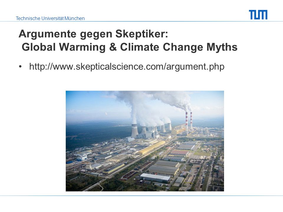
Argumente gegen Skeptiker: Global Warming & Climate Change Myths
Ähnliche Präsentationen


>")
>")


 Germans are on military time which is 1-24>")


