Präsentation herunterladen
Die Präsentation wird geladen. Bitte warten

1
Needs and use of post processing and model interpretation, examples
Model fields: calculated parameters from one model or an ensemble of model forecasts as new GRIB DMO and Model output statistics (MOS) Weather parameters near the surface for many (1000) locations, deterministic and probabilistic T. Kratzsch, DWD, WV1
 Weather parameters near the surface for many (1000) locations, deterministic and probabilistic. T. Kratzsch, DWD, WV1.")
2
List of forecast Parameters for the customers
/// /// /// /// // // // /// /// 03 / / / / / / //// /// /// /// //// /// /// /// /// // // // /// /// 03 / / / / / / //// /// /// /// //// /// /// /// /// // // // /// /// 03 / / / / / / //// /// /// /// //// /// /// /// /// // // // /// /// 03 / / / / / / //// /// /// /// //// /// /// /// /// // // // /// /// 03 / / / / / / //// /// /// /// //// 08 07 /// // //// /// /// /// //// 10 08 /// /// // /// /// 02 / //// /// /// /// //// 11 08 /// /// // /// /// 02 / //// /// /// /// //// 12 07 /// /// // / //// /// /// /// //// 12 07 /// /// // /// /// 03 / //// /// /// /// //// 12 07 /// /// // /// /// 03 / //// /// /// /// //// 13 06 /// /// // //// /// /// /// //// 13 06 /// /// // /// /// 03 / //// /// /// /// //// 13 06 /// /// // /// /// 03 / //// /// /// /// //// 13 06 /// /// // / //// /// /// /// //// 13 07 /// /// // /// /// 80 / //// /// /// /// //// 13 07 /// /// // /// /// 80 / //// /// /// /// //// 12 07 14 /// // //// /// /// /// //// 12 07 /// /// // /// /// 03 / //// /// /// /// //// 11 07 /// /// // /// /// 03 / //// /// /// /// //// 10 08 /// /// // / //// /// /// /// //// 10 07 /// /// // /// /// 03 / //// /// /// /// //// 09 07 /// /// // /// /// 03 / //// /// /// /// //// 09 07 /// /// // //// /// /// /// //// List of forecast Parameters for the customers

3
„WANTED“ …. und weitere Zielgröße benutzte Größen in NinJo vorhanden
in NinJo vorhanden nicht vorhanden Sonnenscheindauer (Minuten/Stunde) und relativ Globalstrahlung (Stundensumme) div. Parameter der Sonnenbahn Beleuchtungsstärke Windrichtung 100m-Wind (stdl.), div. Höhen 100m-Wind (3-stdl.) Windgeschwindigkeit 100m-Wind (stdl.), div. Höhen Diffusionskategorie Windgeschwindigkeit, Gesamtbe-deckung, Tageszeit …. und weitere
 und relativ. Globalstrahlung (Stundensumme) div. Parameter der Sonnenbahn. Beleuchtungsstärke. Windrichtung 100m-Wind (stdl.), div. Höhen. 100m-Wind (3-stdl.) Windgeschwindigkeit 100m-Wind (stdl.), div. Höhen. Diffusionskategorie. Windgeschwindigkeit, Gesamtbe-deckung, Tageszeit. …. und weitere.")
4
Model fields: calculated parameters from one model or an ensemble of model forecasts as new GRIB
The role of the meteorologist: Understand what the models does, i.e. reasons for increasing/decreasing of intensity Spread of the lowest and strongest solution in an ensemble Comparison of different models (area, time, intensity of met. events) Useful parameters, that are not model values (fog, Ceiling) Describe that (Guidance texts) and react if model goes wrong Comparison is much easier with combined / resulting parameters (ww, rain amount) Monitoring of predictands for severe weather events (SDI, tornado parameters, severe ice etc)
 Useful parameters, that are not model values (fog, Ceiling) Describe that (Guidance texts) and react if model goes wrong. Comparison is much easier with combined / resulting parameters (ww, rain amount) Monitoring of predictands for severe weather events (SDI, tornado parameters, severe ice etc)")
5
Interpretation of Ensemble results: Don‘t look for 50 members but for the Prob. of predictible values Probability fields for tresholds of wind gusts and rainfall, Areas of low preasure or large values of CAPE or CIN Probabilities do not replace deterministic values for both – meteorologists and customers! Met. and users need deterministic forecasts and warnings (Guidances) Probs for warning tresholds transformed to Guidance (first guess) of deterministic warnings (severeness and duration)
 Probs for warning tresholds transformed to Guidance (first guess) of deterministic warnings (severeness and duration).")
6
Samstag, 12 UTC ww + Bodendruck + Fronten 06.08., H Z + T 500 hPa 06.08., H

7
Sonntag, 12 UTC ww + Bodendruck + Fronten 06.08., H Z + T 500 hPa 06.08., H Z 300 hPa / Omega 700hPa 06.08., UTC

8
Analyse (A-Format), 04.08., 06 UTC
Z 300 hPa / Omega 700 hPa 04.08., H

9
Heute, 06 UTC Z 300 hPa / Omega 700hPa 06.08., 06 UTC
Analyse, 06 UTC, A-Format

10
Sonntag, 12 UTC GME, 23.07., 00 + 84 H Z 300 hPa / Omega 700 hPa
GME, TKB + ww

11
12-std. Niederschlag bis Samstag, 18 UTC, COSMO-EU, 06. 08
12-std. Niederschlag bis Samstag, 18 UTC, COSMO-EU, , … 66 H 12-std. Gewitterwahrscheinlichkeit, MOS(EZMW), , …66 H
, , …66 H.")
12
Prob RR > 1 mm, MOS(EZMW)
09.07., … 90 H Simuliertes Sat-Bild (EZMW) 08.07., H
 , H.")
13
fx, COSMO-DE, 23.07., H

14
Mittwoch, 18 UTC CAPE + Lifting Index GFS, 09.07., 00 + 162 H
Z + T 850 hPa

15
COSMO-DE, ww, , H + Blitzbeobachtungen

18
EZMW, Z 1000 hPa EPS-Mittel für Sonntag, 16.August, 12 UTC
Modelllauf vom , 00 UTC Modelllauf vom , 12 UTC EZMW, Z 1000 hPa EPS-Mittel für Sonntag, 16.August, 12 UTC Modelllauf vom , 00 UTC Modelllauf vom , 12 UTC

19
EPS des EZMW: Kumulative Verteilungs-
Funktion der einzelnen Vorhersagen Rot: , 12 UTC Violett: , 00 UTC Dunkelblau: , 12 UTC usw.

20
Kombinierte EFI-Karte, 22.07., 12 UTC

21
Do Fr Sa So Mo Di Mi Do Fr Sa So

22
„WANTED“ seit 2005 / 2007: Parameter in der Grenzschicht / Bodennähe:
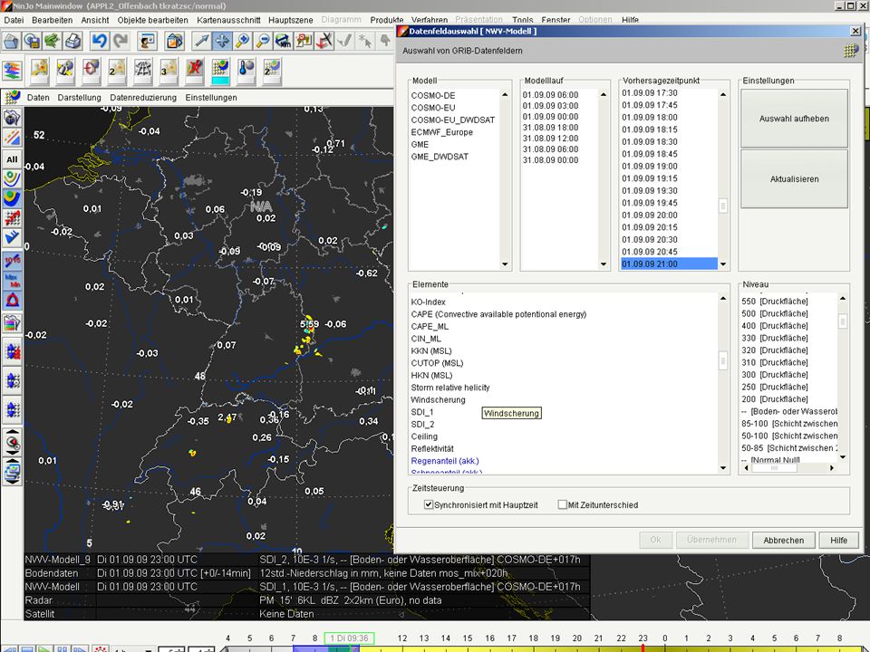
Relative Feuchte in 975 hPa Eckertscher Nebelindex auf LMK Basis Ceiling nach TAF Kriterien (Wolkenuntergrenze mit Bedeckungsgrad >= 4/8) lokale Feuchteänderung (zeitlich, z.B. 1stg. / 3stg.) als Hinweis für Tornadobildung aus LMK Konvektionsparameter als Grib-Felder: Parameter werden mittels der Umgebungsmethode (Berücksichtigung auch der Nachbargitterpunkte) berechnet. Konvektionsparameter: Lifting Condensation Level, Level of Free Convection Mixed-Layer CAPE over 0-3 km, Experimental Spout/Tornado index Equilibrium Level Convective Cloud Top Temperature MSL Pressure, 500 hPa Height, Mixed-Layer CAPE (lowest 1000m parcel) Supercell Detection Index (SDI) vertikale Windscherung 0-1km, 0-3km, 0-6km aus LMK als Tornadohinweis weitere Tornado-Indizes, vgl. an Dr. Seifert, Papier von Herrn Friedrich aus 2005 Vereisungsprognose: ADWICE auf Basis des LMK Schneefallgrenze oder /und Nullgradgrenze aus LME und LMK
 lokale Feuchteänderung (zeitlich, z.B. 1stg. / 3stg.) als Hinweis für Tornadobildung aus LMK. Konvektionsparameter als Grib-Felder: Parameter werden mittels der Umgebungsmethode (Berücksichtigung auch der Nachbargitterpunkte) berechnet. Konvektionsparameter: Lifting Condensation Level, Level of Free Convection. Mixed-Layer CAPE over 0-3 km, Experimental Spout/Tornado index. Equilibrium Level Convective Cloud Top Temperature. MSL Pressure, 500 hPa Height, Mixed-Layer CAPE (lowest 1000m parcel) Supercell Detection Index (SDI) vertikale Windscherung 0-1km, 0-3km, 0-6km aus LMK als Tornadohinweis. weitere Tornado-Indizes, vgl. an Dr. Seifert, Papier von Herrn Friedrich aus Vereisungsprognose: ADWICE auf Basis des LMK. Schneefallgrenze oder /und Nullgradgrenze aus LME und LMK.")
23
How to give deterministic and probabilistic forecasts
to users/customers that are interested in (deterministic) values for locations from high resolution models? Use of interpretation methods from global models in high resolution models? How to communicate uncertainty?
 values for locations from high resolution models Use of interpretation methods from global models in high resolution models How to communicate uncertainty")
Ähnliche Präsentationen


 VDB VDB' DB DB' o = lösche(aname) p?? v v = AName (ArtikelArt) n Löschen entspricht der relationenalgebraischen Differenz. Dann ergibt.>")


>")


 Zielsetzung von STAMPF:>")


